Address
304 North Cardinal
St. Dorchester Center, MA 02124
Work Hours
Monday to Friday: 7AM - 7PM
Weekend: 10AM - 5PM
Address
304 North Cardinal
St. Dorchester Center, MA 02124
Work Hours
Monday to Friday: 7AM - 7PM
Weekend: 10AM - 5PM


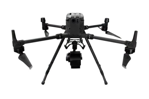
The hyperspectral camera based on DJI SDK payload, compatible with DJI Matrice 300 RTK, FS60 M300 hyperspectral camera adopts ultra-high-speed imaging device with high signal-to-noise ratio to provide high-stability spectral image acquisition; adopts self-developed image processing algorithm with high efficiency and low power consumption, which greatly prolongs the flight time of the whole machine and reduces the power consumption of the system. consumption. Through real-time measurement of spectral image information of plants, water bodies, soil and other ground objects, it can be applied to precision agriculture, crop growth and yield assessment, forest pest and disease monitoring and fire monitoring, coastline and marine environment monitoring, lake and watershed environmental monitoring and other applications.
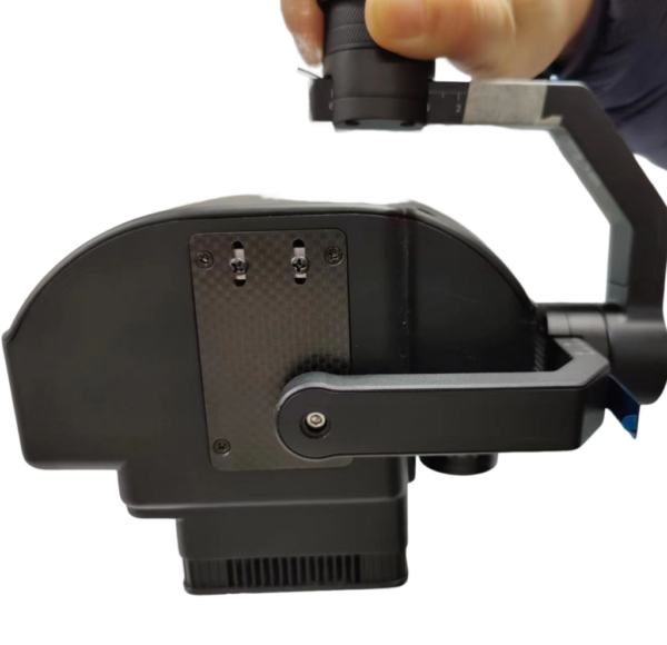
The DJI M300 hyperspectral sensor design is compact, and the imaging spectrometer mainframe has a high spectral resolution. The whole machine consists of: a high-stability pan/tilt, hyperspectral imager, large-capacity storage system, wireless image system, GPS navigation system, ground receiving workstation, and ground control system.
Features;
Application;
By measuring the spectral image information of plants, water bodies, soil, and other ground objects in real-time, it can be applied to precision agriculture and crop growth
and yield assessment, forest pest monitoring and fire monitoring, coastline and marine environmental monitoring, lake, and watershed environmental monitoring
testing applications;
Specs;
| SN | Specs | |
| 1 | Light splitting method | Transmission grating splitting |
| 2 | Spectral range | 400-1000nm |
| 3 | spectral band | 1200 |
| 4 | spectral resolution | 2.5nm |
| 5 | Slit width | ≤25um |
| 6 | spectral efficiency | >60% |
| 7 | stray light | <0.5% |
| 8 | Spatial Pixels | 1920 |
| 9 | pixel size | 5.86um |
| 10 | Imaging speed | Full band 128Hz, Max 3300Hz |
| 11 | detector | CMOS |
| 12 | SNR(Peak) | 600/1 |
| 13 | output interface | USB |
| 14 | Camera interface | C-Mount |
| 15 | ROI Function | Multiple regions possible |
| 16 | Built-in embedded data acquisition and processing unit | Windows operating system, 8G memory, 1TB solid-state hard disk, with HDMI interface, USB3.0 interface, integrated design with camera |
| 17 | Cooling method | Internal air cooling |
| 18 | Observation method | Real-time observation of aircraft sampling locations, hyperspectral images, spectral data, and functions through ground stations |
| 19 | Calibration method | Radiosity correction, reflectivity correction, area correction support batch processing |
| 20 | Data Format | Compatible with spe format, hdr format, scp format |
| 21 | size | 206*129*119mm |
| 22 | Weight | 1150g |
| 23 | Accessories | Reflectance Calibration Plate |
| 24 | lens focal length | 25mm |
| 25 | FOV | 25° |
| Weight | 1.2 kg |
|---|---|
| Dimensions | 12 × 15 × 12 cm |